6 ways my mapmaking has changed over time
There are so many different reasons to make a map. At one end of the spectrum we have pure geographical necessity eg. a visitor map:


Summer and winter visitor maps for Lowther Castle in Cumbria
Or a town map:

Morpeth Food Festival map
At the other end there are all kinds of storytelling, from celebrating a life well-lived:


A surprise 80th birthday gift for Mr. Swann, incorporating his family, his childhood in Bedlington, his favourite cars, homes, hobbies, and his beloved wife Dorothy.
…to explaining what’s going on inside my own head:
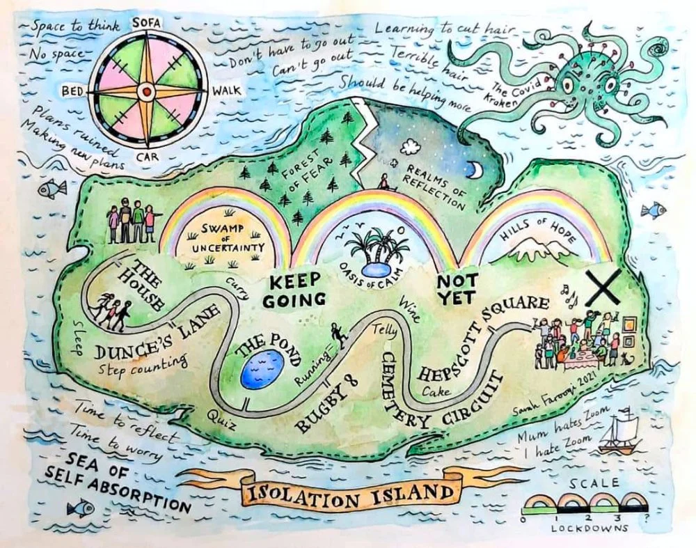
All you need to know about my experiences of lockdown! Originally for the “Behind the Mask” exhibition at Gallery 45, this painting was purchased and gifted to the Northumbrian Community in Old Felton.
So how have things changed?
Refining how I begin
Once we have talked about who the map is for and what it needs to do, I have a think about what information I’m going to ask for. This invariably leads to a little homework for the client. I have tripped up in the past. On occasion I haven’t been clear enough, and the client has spent their valuable time sourcing pictures which I could have found myself, when I actually needed pictures personal to them, photos which can be surprisingly difficult to find! Ideas and information have occasionally trickled in much later in the project, and I’ve found myself adding/revising things as I go along, which can take extra time.
As a visual person, it’s easy to assume that everyone sees the path/pitfalls ahead in the same way that I do, and it just isn’t the case. Over time, I’ve learned to see things more through my clients’ eyes. I ask for everything all at once, and I aim to do it in a clear, concise way. There are always projects waiting in the wings, so a little guidance about when I need things is also very handy in terms of moving things along!
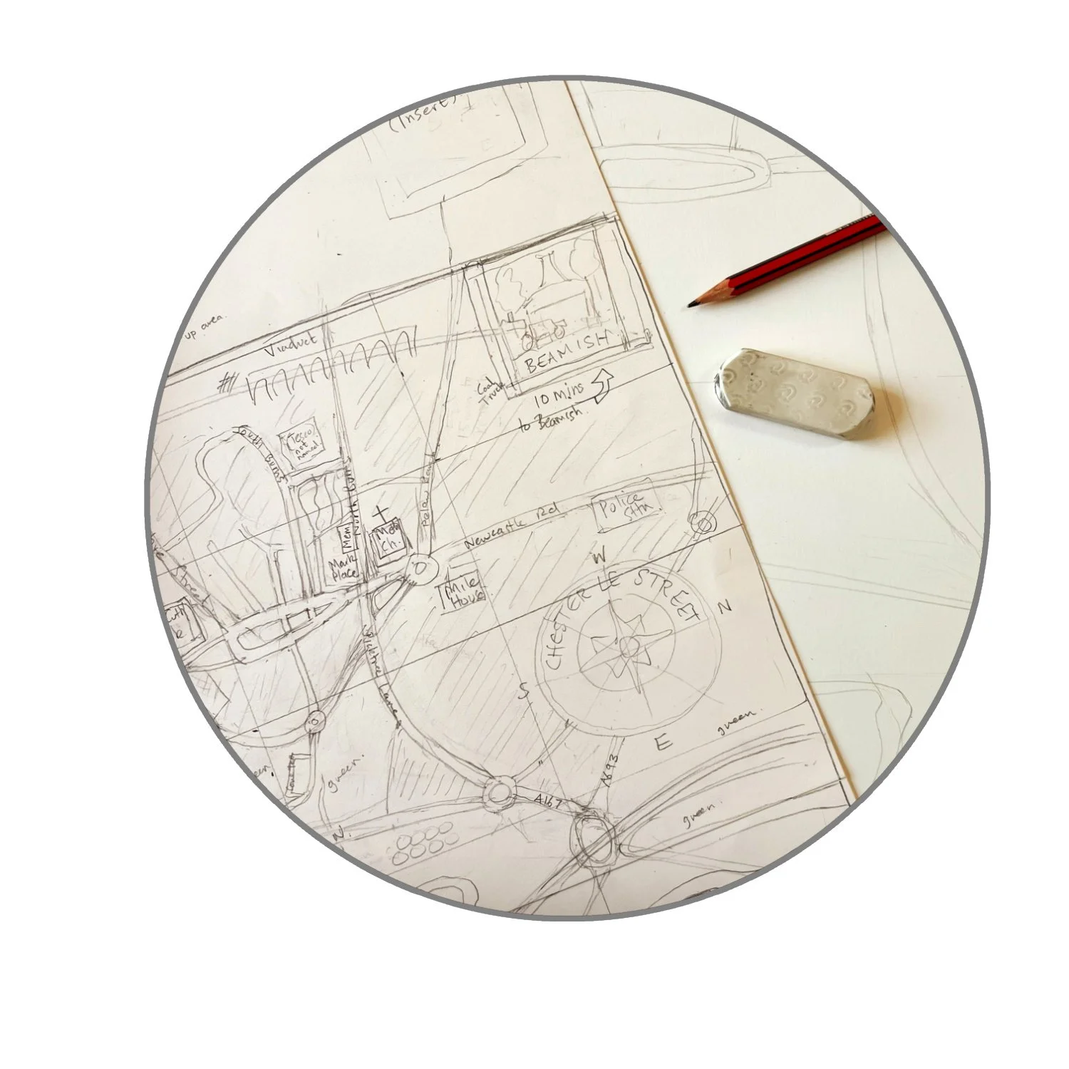
2. Streamlining the sketch
The aim of my initial sketch is to give the client an overview of the composition, and how everything might fit together. It’s a nice way into the process for both of us, and it gives us confidence that we are thinking along the same lines. If we aren’t then I can try again without having wasted too much time (this hasn’t happened yet but there is always a first time!). I must admit that I do sometimes get carried away adding detail to what’s supposed to be a very quick sketch, but here are a couple of recent examples where I’ve been a bit more successful at reining in the detail:

This will be a map spanning parts of Northern England and parts of the USA.
A radical departure for me, but adding the places on bits of paper meant I could move things around without redrawing everything - obvious really!
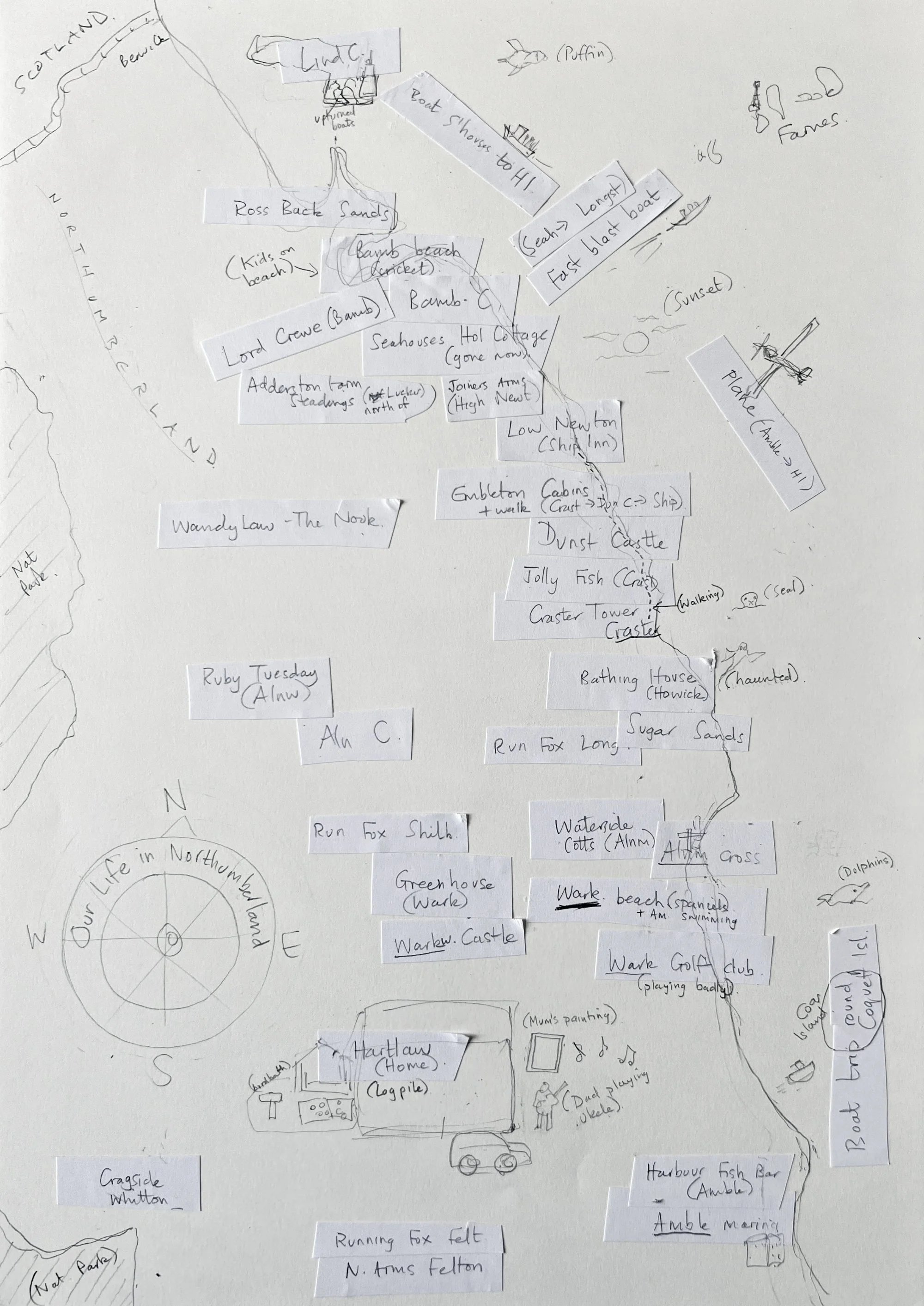
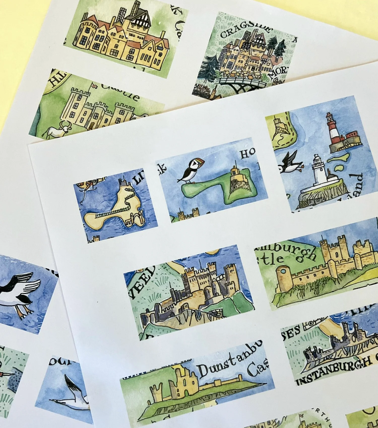
3. Using the internet
I used to create sheets of reference pictures which I would print out and staple together and keep in a cardboard folder. However, I could never seem to find the right picture on the right bit of paper.
I have also printed out details from illustrations on previous maps I have painted in order to use as reference:
But even though I’ve painted Longstone Lighthouse (for example) several times, I find that I always want to look at photos/sketches of the real thing before I paint it again. I see new things every time I look at something familiar with fresh eyes, and the thought of just copying an illustration I’ve already done makes me feel sad.
I’ve also tried making photo albums for each project on my phone. However, I end up endlessly scrolling to try and find the picture I’m looking for.
My current system is to accept that I will be searching (Googling) constantly and not to worry about that. The internet is a wonderful resource and the time I spend typing in a search bar is time I don’t have to spend looking for bits of paper or scrolling through albums I’ve already spent time collating. It’s filled with photos from many different angles, and this is also very helpful.
I was so happy when I figured out a way to “triangulate” places on Google Maps. By this, I mean seeing where several places are in relation to each other. My maps don’t always need to be accurate geographically, but I can make sure that they are close enough. As a perfectionist (and not always in a good way) knowing that I have the satellite information at my fingertips makes my life a lot easier.
Likewise with Google Earth. I can virtually walk down most streets and see what the buildings look like. It’s really so clever.
4. Being extra careful with the drawing
The pencil drawing is probably the most time-consuming part of making a map, but it’s time well-spent. This is where I “learn” how to draw all of the elements I need to illustrate, and it can’t be rushed. Here’s a detail from a recent map showing Longstone Lighthouse as an example…

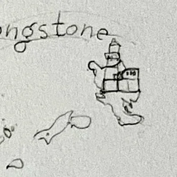
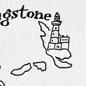

The first detail is the thumbnail sketch. The second is the drawing I made after looking at lots of pictures of Longstone. So now I know how it looks, and I retain that memory for when I draw it again in ink (the 3rd detail). The ink drawing is easier because I already know how to do it, although I do still look at pictures as I go along. The 4th detail shows the finished painting, and I often still refer to pictures to remind myself which colours go where.
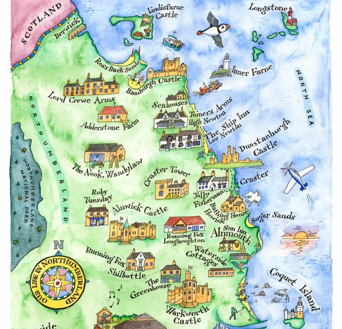
Here’s part of the finished map, with Longstone in all its glory.
5. Experimenting with colour
My first few maps were mainly shades of green and blue. I do love a restricted pallette and it works well:

Northumberland - England’s Border Country. This was my first map, and it’s still popular.
One day, I decided to risk adding some warmer colours to a map, and I found I also really liked that! It began with some pale purple in a top corner, to represent Scotland:
This map was a gift from a lovely man to his partner. He’s no longer with us, so I will always remember this as a very special project.
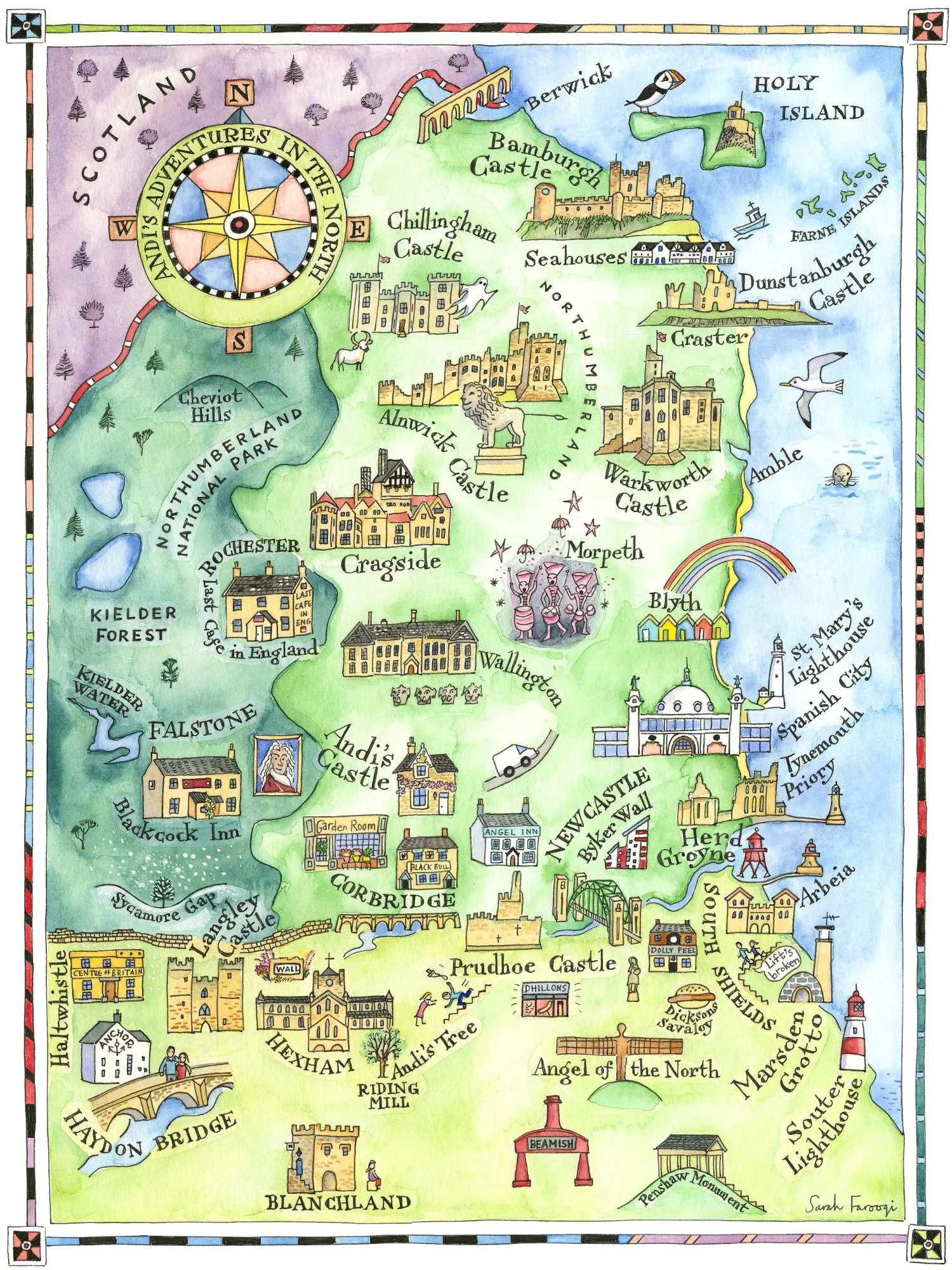
…and it has grown over the years into all kinds of different colours from purples, pinks, oranges, browns and yellows:
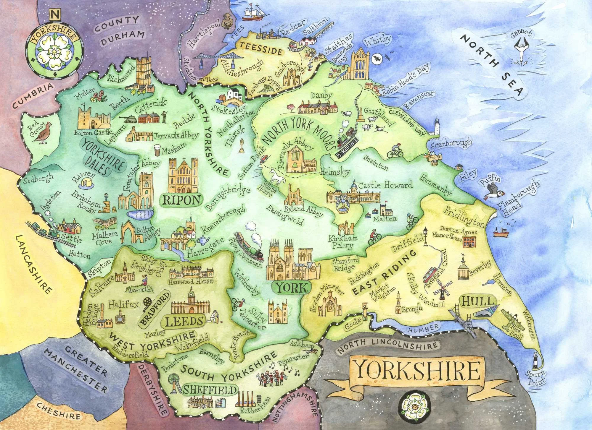
Yorkshire - God’s Own County. The different areas of colour on this map make it work really well on a jigsaw. It’s tricky, but at least you can sort the pieces into piles of different colour.
6. It’s maybe not just a map
In 2022 I was asked to make a map for the Lindisfarne Gospels Exhibition at the Laing Art Gallery in Newcastle. So far so straightforward. Then I sat down with the commissioner to talk through the information which needed to be illustrated. I was given a huge document which included not only the geography, but historical facts, stories, spiritual ideas, and a sprinkling of science/technology. Oh yes, and it needed to be understood and remembered by children of all school ages. A few years ago I would have had a panic attack!
It helped that the client was very kind and gave me a lot of freedom. So I managed to stay calm and began to sketch out some ideas. Any excuse to look at pictures of the Lindisfarne Gospels is welcome, and I love the way the monks played around with decorative elements, Celtic knotwork, little insets, colour and typography. So I copied their approach, and came up with an illustration which is part map and part everything else:

It’s one of my favourite projects and it helped me to think outside the box when making a map. I was given permission to publish this painting as a print, card and jigsaw, for which I am very grateful.
To conclude, I think my mapmaking has developed over the years. I am more focused and ask for the information I need more clearly. I have streamlined the sketching/initial ideas step, but spend longer on all aspects of the drawing. I have embraced the internet, Google Maps and Google Earth. I am more adventurous with colour, and more willing to work elements of landscape and illustration into my maps.
One thing that hasn’t changed is the pleasure I get from making them!